
Iowa Civil War Monuments
Louisa County
Grandview - Freedom Rock and Veterans Memorial GPS Coordinates: 41.277300 by -91.196000
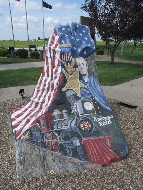
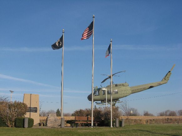
There is an impressive Veterans memorial at the entrance to Grandview. It was dedicated July 4, 1991 led by the Louisa County Vietnam Veterans. It includes a Freedom Rock painted by artist Ray "Bubba" Sorensen. The west side of the Rock is dedicated to William Reddick. He was one of the Andrews' Raiders - this was also called the Great Locomotive Chase. Reddick was captured by the Confederates but later released in a prisoner exchange. He was one of the first recipients of the Medal of Honor. He was a member of the Ohio 33rd Infantry, but settled in this region after the War and is buried in the Letts Cemetery only a few miles away. Please see more information listed under Letts in Louisa County. This memorial is located at the intersection of Highways 61 and 92. The photo of the Rock was taken 8/12/20. The photo of the helicopter and flags was taken 1/9/08.
Grandview - Veterans Monument GPS Coordinates: 41.278116 by -91.174366
This monument honors Veterans from a number of Wars. It is in the Cemetery about one half mile east of town. It is granite about 3½ feet high and 2½ feet wide. The monument is located by the flagpole and across the road from the shed. The Photo was taken 11/26/08.

Letts - Veterans Memorial GPS Coordinates: 41.328266 by -91.228383
This is dedicated to veterans of all wars. It is granite about 4 feet high and 5 feet wide. Letts is a small town on the north edge of Louisa County and west of Highway 61. The cemetery is just east of town. Photo taken 1/9/08.

Toolesboro - Littleton Brothers Monument GPS Coordinates: 41.141667 by -91.062778
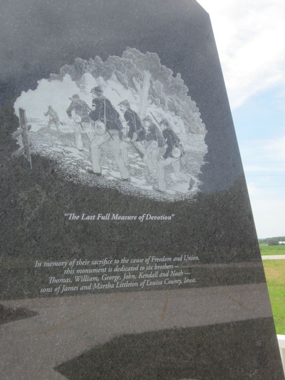
This impressive monument was dedicated June 14, 2016 to the memory of the six Littleton Brothers who lost their lives in the Civil War. They perished due to death in battle, illness, accident and as prisoner of war. The monument is black granite and about 11 feet in height. The front has an etching representing the brothers, Thomas, William, George, John, Kendall and Noah. The back side has a history of the brothers and their family. The left side lists the brothers and their regiments. Thanks to Tom Woodruff and Ed Bayne for uncovering this amazing story of the brothers and leading the effort to recognize them with this monument. It is located on Highway 99 at the entrance to the Toolesboro Indian Monument Historical Site, just outside the small town of Toolesboro. Photos taken 6/14/16, 6/25/16 and 8/12/20.



Toolesboro - Mallory Cemetery Plaque to Confederate Soldiers GPS Coordinates: 41.149617 by -91.092933
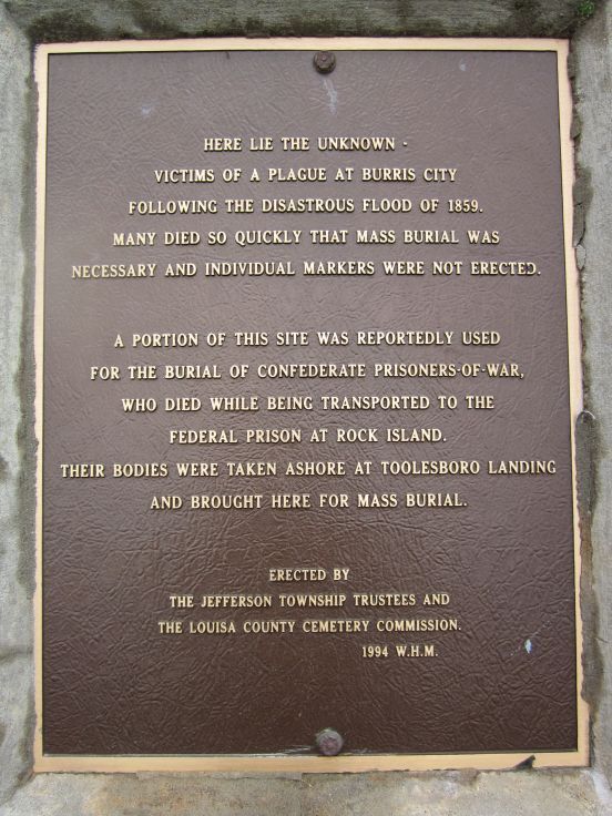
This plaque recognizes those buried here in unmarked graves from the town of Burris City (which no longer exists) and Confederate soldiers who are said to have died while being transported to prison at Rock Island. Burris City, at the confluence of the Iowa and Mississippi Rivers, was flooded in 1858 and many residents died during cholera or yellow fever epidemics. Mallory Cemetery is a beauitiful little cemetery about 9 miles southeast of Wapello on County Road 99. Thank you to Steve Hanken for notification of this monument. Photos taken 5/28/11.
Wapello - Civil War Monument GPS Coordinates: 41.194000 by -91.206400
This monument was erected by the WRC. It is located in the Wapello Cemetery just north and west of town. There are 4 sunken cannonballs around the monument. Thank you to Steve Hanken for information. Follow 100th Street west off Highway 61 to the cemetery. Then take the left entrance, drive straight ahead, and the monument is on the right side of the road. Photos taken 8/12/20.

